Subject to Change
The course will be a combination of trails and road running going through the following parks and neighborhoods:
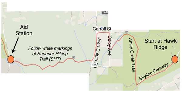
- Hawk Ridge
- Superior Hiking Trail Spur
- Woodland
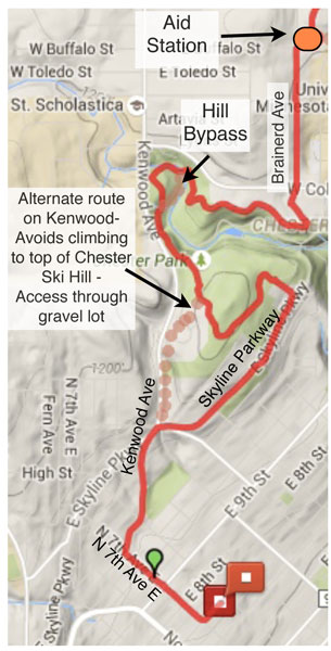
- Hartley Nature Center
- Bagley Nature Center
- Chester Bowl
- Bowen-Bailey home
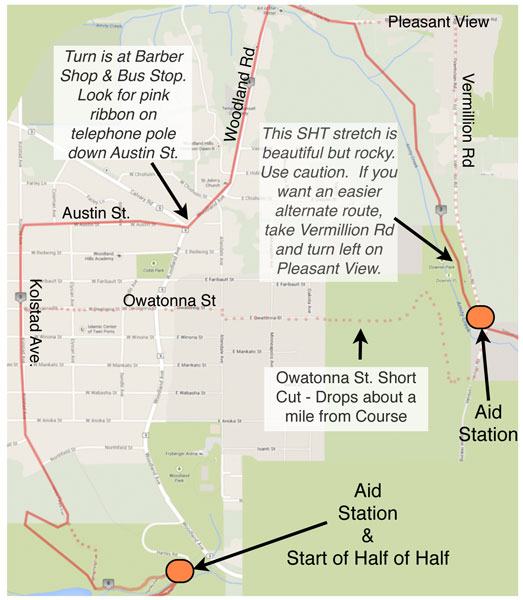
The map below has a tentative course. This equates to just over 13 miles – but is based on taking a more circuitous route within Hartley, Bagley, and Chester. No one is obligated to run the extra mileage to make it to 13 miles. (You get pie either way.)
Below are maps of the 4 parts of the race. Click on the image to see the complete map.
Download 2015 Homemade Half Map Cards
Aid Stations: We plan to offer a couple of aid stations. For sure, there will be one at Hartley Nature Center parking lot. We also should have one near Bagley Nature Center
Posted in: Run Information